
Base Map
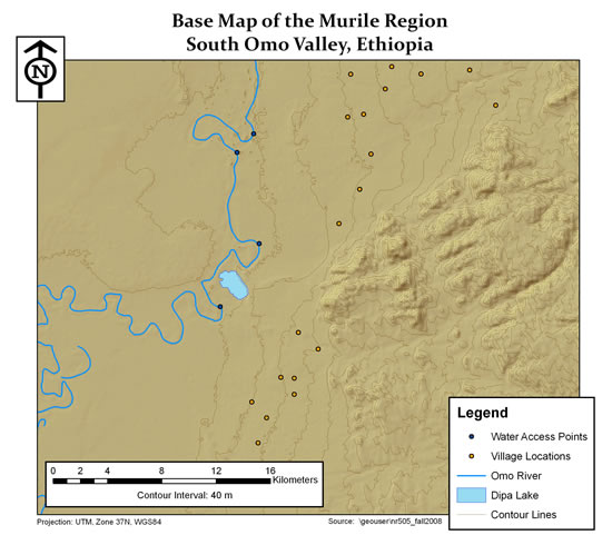
This base map shows the portion of the South Omo Valley known as the Murile Region. Our study site encompasses the area between the village locations (shown as orange points) and the water access points (shown as dark blue points) on the east side of the Omo River. The topography in the region is gently rolling terrain along the valley bottom with deeply incised, steep river banks.
Elevation in the area ranges from approximately 400 m to 1320 m above sea level.
return to top
