
Introduction
Location Map
Base Map
Database Schema
Conventions
GIS Analyses
Flowchart
GIS Concepts
Results
Conclusion
References

From Villages to Water Sources:
A Least-Cost Travel Anaylsis in the Murile Region,
S. Omo, Ethiopia
Authors: Nate Page & Lina Polvi
Contact: nrpage@gmail.com & lepolvi@cnr.colostate.edu
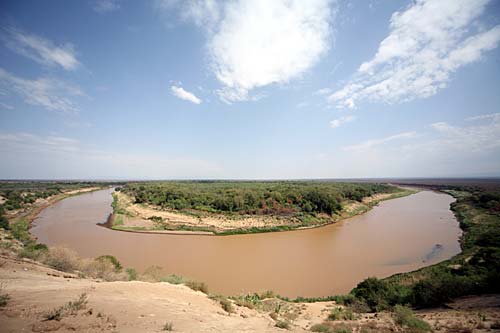
The South Omo River - Murile Region.
Introduction
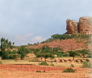
 The Murile Region is located in the South Omo River Valley of Ethiopia. This remote, fertile Ethiopian valley is home to several tribes including the Hamer, Karo and Bume. The Karo Tribe, numbering around 800, is the main agriculturalist tribe in the region. At one time the Karo were rich cattle owners, but after a tsetse fly blight destroyed their herd they have been reduced to subsistence on maize, beans and sorghum all of which they farm on the banks of the Omo River and Dipa Lake ("South Ethiopia: The Karo"). Surrounded by Tribes of much greater numbers in all directions the Karo have realized a need for peaceful relationships with their neighbors. The Hamer and the Bume Tribes, both numbering in the 20,000’s, frequently have hostile encounters which often catch the small Karo Tribe in the middle.
South Omo Valley
 Water is one of the most important resources in the South Omo Valley. Due to the steeply incised banks along most of the Omo River throughout the valley there are only a few points of access to the river water along the bank. Conservation of human energy is very important in subsistence living communities especially when resources are scarce and/or points of contention with neighboring tribes. With this in mind we have identified 4 different points of access to water along the Omo River and several village locations throughout the region. We also have local topography in the form of a 90 m Digital Elevation Model (DEM). The GIS analysis performed in our study resulted in a path of least energy cost from village locations to water sources. This analysis takes into consideration and minimizes the distance traveled and elevation gained along the paths of travel. Ideally the results of our least cost paths indicate the most efficient routes to access water.
Our analysis does not take into consideration factors such as micro-topography not indicated on our 90 m DEM, tributaries of the Omo River that may be difficult to cross, hostile areas that should be avoided or vegetation that may pose an obstacle to foot travel.
Data Collection:
The original data used in this analysis includes a 90 m digital elevation model (DEM) of Ethiopia and a Russian paper map of the Murile Region. The paper map was provided by The Murulle Foundation and features were marked on the map by a representative of Ethiopian Rift Valley Safaris. Features marked on the map include water access points and village locations. Village locations were categorized into settlements of greater than 20 people and settlements of less than 20 people. For this analysis we chose to include only the village locations of less than 20 people because these villages are in general further from marked water sources and therefore provide a more interesting study result. The larger villages marked on the paper map tend to be located immediately adjacent to a water access point and therefore would not provide such interesting results from a least-cost distance analysis.