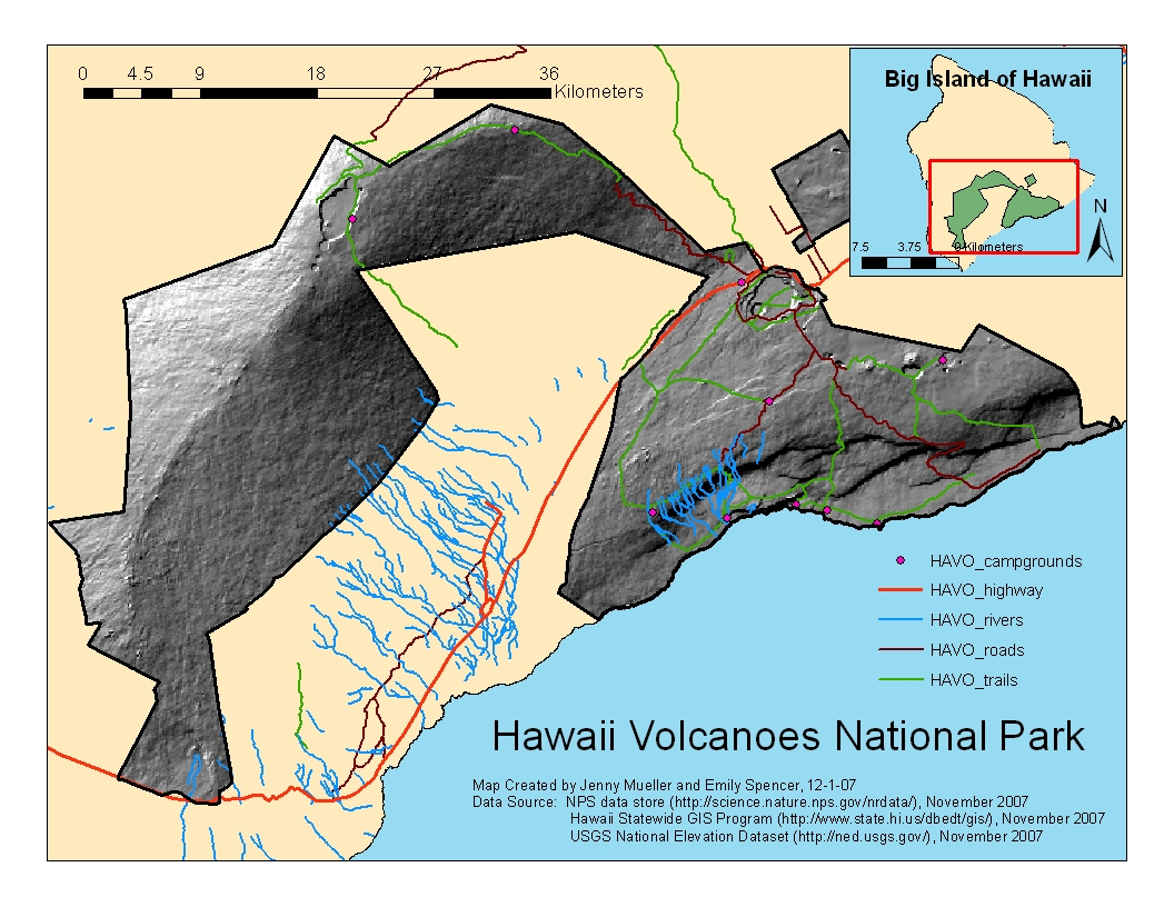
Hawaii Volcanoes National Park (HAVO) |
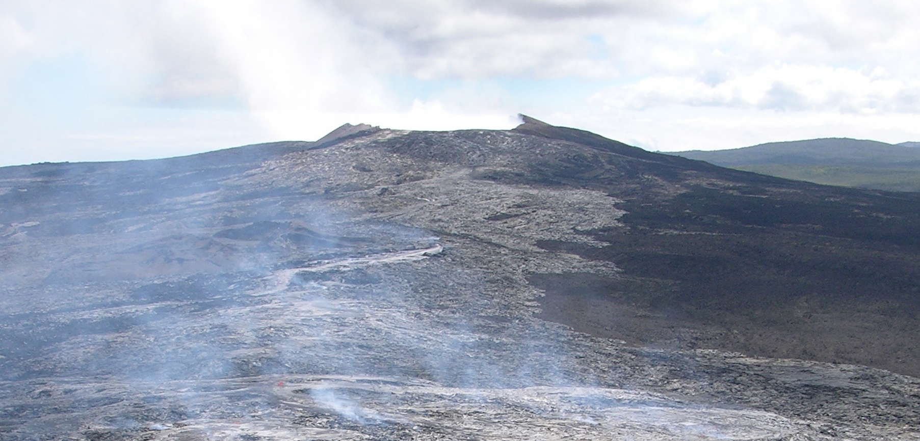
Established in 1916, Hawaii Volcanoes National Park is located on the southeastern part of the Big Island of Hawaii. The park encompasses an area of approximately 323,000 acres and contains the volcanoes of Kilauea and Mauna Loa, which are two of the world's most active volocanoes. Photo courtesy of NPS (www.nps.gov/havo)
Analysis: Area of Potential Restoration for Ischaemum byrone by Evaluating Threats
Flow Charts of Raster and Vector Analyses
Explanation of GIS Concepts and Analyses
Results
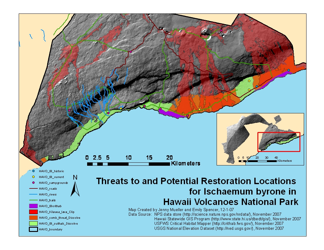
The green layer (HAVO_IB_suithab_Dissolve) in the map "Threats to and Potential Restoration Locations for Ischaemum byrone in Hawaii Volcanoes National Park" represents the area that, according to published literature (USFWS 1996) meets two of the seemingly most important habitat criteria for the grass in coastal dry shrublands: elevation between 0-250 feet (0-76.22 m) and recent lava flow substrate, such as pahoehoe and a'a lava. The total area that meets these two criteria is 15,228 acres.
Conclusions
"Threats" were identified as both natural and human-caused activities that could adversely affect current and potential grass populations, such as active lava flows, fire, roads, trails, and developed areas, such as campgrounds and other park infrastructures. Each of these threats, with the exception of fire, was then buffered a seemingly appropriate distance (50-100 feet for trails, roads, and campgrounds). Lava was buffered half of a mile because of its variable nature. The area of these buffered threats (in orange, HAVO_comb_threat_Dissolve ~ 9,650 acres) were then subtracted from the total suitable habitat (in green), resulting in approximately 5,578 acres of 15,228 total possible acres (37%) that are potentially suited for Ischaemum byrone restoration based on elevation and soil type alone. Lava represents a majority of these threats. Buffered roads, trails, campgrounds spatially represents a very small area and at this scale do not appear. No other structures occurred within the suitable habitat area.
Representing fire threat to suitable habitat is challenging without knowing current vegetation conditions. It is also impossible to predict fire starts. However, according to the fire atlas layer used in this analysis, what we can say about this dry coastal shrubland habitat regarding fire is that it certainly is fire-prone and likely fire adapted, as approximately 50% of the fires recorded since 1931 within the suitable habitat area were started by lava. Twenty-five percent of fires were unintentional human ignitions and the remaining 25% were either prescribed burns or of an unknown ignition source.
What this limited analysis shows is that historic populations (blue points) are historic because of lava flows (confirmed by Pratt 2007and Belfield 2007) and that many of the current (restored) populations (yellow points) are relatively close to one or more types of threats. The exception is the western-most current population, which seems to be at or near the maximum described elevational range for the species. The safest area for future restoration efforts appears to be the western-most part of the suitable habitat layer, where really only trails and a campground exist.