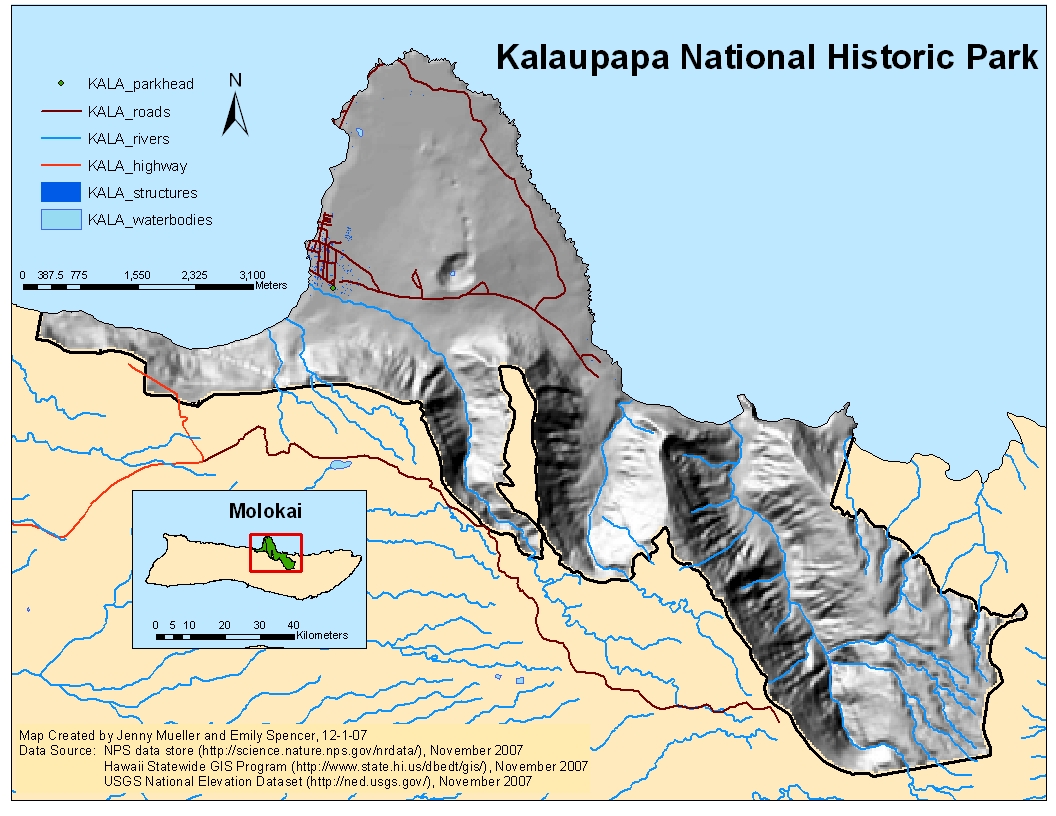
Kalaupapa National Historic Park (KALA) |
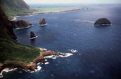
Kalaupapa National Historic Park, established in 1980, is located on the northern Kalaupapa peninsula on the island of Molokai. The park, encompassing an area of more than 10,700 acres, was the location for isolating Hawaiian people who were afflicted with leprosy from 1866 to 1969. Photo courtesy of NPS (www.nps.gov/kala)
Analysis: Area of Potential Restoration for Ischaemum byrone by Evaluating Threats
Flow Charts of Raster and Vector Analyses
Explanation of GIS Concepts and Analyses
Results
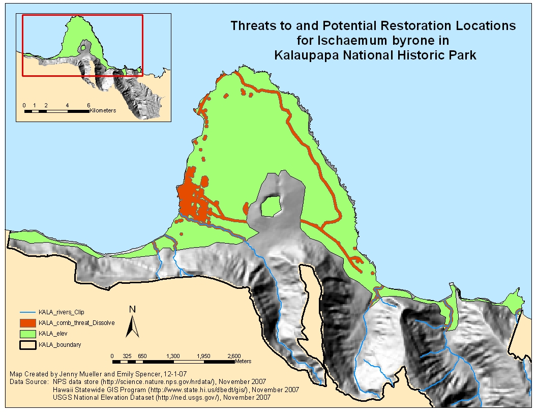
In the map "Threats to and Potential Restoration Locations for Ischaemum byrone in Kalaupapa National Historic Park," the green layer (KALA_elev) represents the area that meets important habitat criteria of elevation between 0-250 feet (0-76.22 m) for the grass in coastal dry shrublands. The total area that meets the elevation criteria is 2,698 acres. The orange layer (HALE_comb_threats_dissolve) in the map represents the area containing of all identified buffered threats to the grass. This total area is 365 acres, yielding a potential restoration area of 2,332 acres by subtracting the area of threats from the original area of suitable elevation.
Conclusions
Ischaemum byrone often grows in substrate from lava flows, especially pahoehoe and a’a lava. These substrates types were not found within the suitable elevation on HALE, and so the suitable habitat for the plant was only based upon the elevation critieria. Approximately 86% of the suitable elevation area within KALA is potential area for restoration of the plant that is not affected by the identified threats. There is no designated critical habitat and no reported current populations of the grass in KALA.
In KALA, "threats" were identified as both natural and human-caused activities that could adversely affect current and potential grass populations, such as active lava flows, fire, roads, trails, and developed areas, such as campgrounds and other park infrastructures. The lava flow data from East Molokai Volcano did not contain any “young” lava flow, or lava flow from the 19th century to present. Data of fire history was not readily available for KALA. Therefore, lava flows and fire were not included in the analysis of threats to potential grass populations. The threats included in the analysis include highway, roads, rivers, and structures, such as park headquarters. Each of these threats was buffered by 100 feet. This buffer distances seemed appropriate to protect potential plant populations from human activities or flood waters near rivers. The majority of the threats are the buffered rivers, roads, and structures.