Introduction
Location Map
Base Map
Database Schema
Conventions
GIS Analyses
Flowchart
GIS Concepts
Results
Conclusion
References
A GIS Application for Trail Suitability within
Bale Mountain National Park, Ethiopia
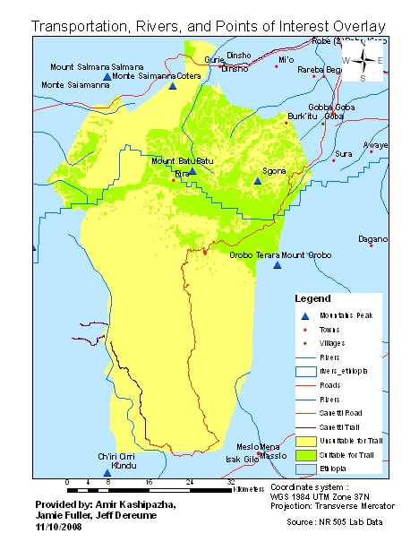
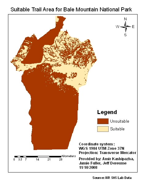
Our GIS analysis shows areas within BMNP that have suitable attributes for developing a new trail system within the park. As expected suitable areas were located in the northern Highlands which contain both moderate slope, high elevations, undisturbed landscape, and access to towns.
This map portrays areas of interest, towns, accessability, and possible water sources. We assume that there are current trails in this area due to the nature of activities within National Parks. Tullu Demtu or Sgona at 4377m, which is Ethiopia’s second highest peak and Sgona is also contained within the suitable regions for new hiking trails, which would be both great to view and incorporate into the trail system. It would be advisable to minimize impact and develop the existing trails into the main-use trail. The areas indicated for suitable trail development should be considered first.