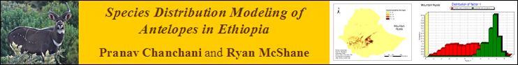
Introduction
Location Map
Base Map
Database Schema
Conventions
GIS Analyses
Flowchart
GIS Concepts
Results
Conclusion
References
Introduction
* Please contact the authors (Pranav Chanchani and Ryan McShane) for further information about this project’s objectives and its implications for the conservation and management of Ethiopian antelope species and about the implementation of the species distribution models used in this project.
Ecology is often described as the study of the distribution and abundance of organisms. For most organisms in the natural world, distribution and abundance are influenced by a complex array of factors including environmental conditions, resource availability, dispersal ability and disturbance. Species are often distributed in seemingly erratic patterns in space. This is an artifact of the availability of suitable habitat, an important parameter in the niche requirements of a plant or animal.
Ecologists and biogeographers have evolved a number of approaches to model species distributions: (i) expert-based (non-statistical, non-empirical) spatial modeling of species distribution; (ii), non-spatial statistical modeling of species-environment relationships based on empirical data; and (iii) spatially-explicit statistical and empirical modeling of species distributions (Guisan and Thuiller 2005).
Several programs, such as Biomapper (Hirzel et al. 2002), Maxent (Phillips et al. 2004) and Garp (Stockwell et al. 1999), facilitate the creation of empirical species distribution models that relate field observations to environmental predictor variables based on statistically- or theoretically-derived response surfaces (Guisan and Zimmermann 2000). Biomapper integrates GIS and spatially-explicit data with the niche concept of ecology and multivariate statistical (ordination) methods to develop predictive species distribution models. Such models are increasingly being integrated into ecology and conservation biology in a number of ways (Guisan and Thuiller 2005):
In this project, we have carried out exploratory analysis and developed habitat suitability models for six species of Ethiopian antelopes based on presence-only data using Biomapper. Biomapper is finicky about the spatial data it accepts as input files. All file preparations and post-analysis operations with GIS data were carried out on ArcGIS. Our specific objectives were: (1) develop an easily replicable protocol to create input files for Biomapper using ArcGIS; (2) use bioclimatic and environmental raster data to develop preliminary habitat suitability models for Ethiopian antelopes; (3) comment on the models developed and discuss merits and challenges in developing habitat suitability models using Biomapper and ArcGIS.– Quantifying the environmental niche of a species;
– Testing biogeographical, ecological and evolutionary hypothesis;
– Assessing species invasion and proliferation;
– Assessing the impacts of climate, land use and other environmental changes on species distributions;
– Suggesting unsurveyed sites of high potential for the occurrence of rare species;
– Supporting appropriate management plans for species recovery and mapping suitable sites for species reintroduction;
– Supporting conservation planning and reserve selection;
– Modeling species assemblages (biodiversity, composition) from individual species predictions.
– Building bio- or ecogeographic regions; and
– Improving the calculation of ecological distance between patches in landscape and meta-population dynamic and gene flow models.
Information on Six Antelope Species in Ethiopia
Animalia
Chordata
Mammalia
Cetartiodactyla
Bovidae
Tragelaphus
buxtoni (Mountain Nyala)
oryx (Common Eland)
strepsiceros (Greater Kudu)
imberbis (Lesser Kudu)
scriptus (Common Bushbuck)
scriptus meneliki (Menelik’s Bushbuck)
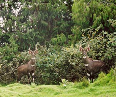
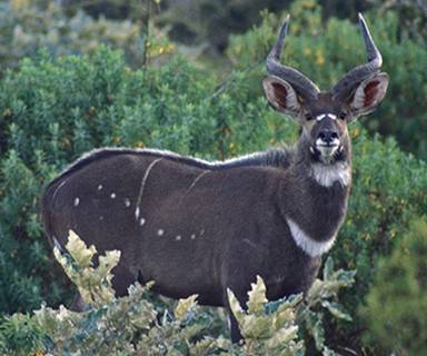
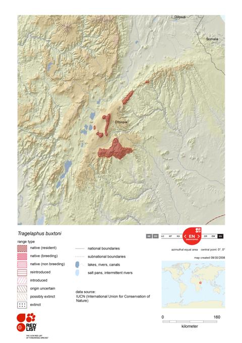
Mountain Nyala (Tragelaphus buxtoni)
Range Map
Habitat and Ecology
Ideal habitat is provided by montane woodlands at 3000 to 3400 m. Mountain Nyala frequents the fringes of montane grasslands (2800 to 3100 m). Highest densities (up to 21 per square km) have been recorded in the montane grasslands of Gaysay, Bale, where there is a combination of browse and grass with woodland cover to retreat to during the day. The formerly large continuous blocks of suitable woodland and Afroalpine habitat have now been reduced to a series of habitat islands in a sea of cultivated fields. It seems likely that Mountain Nyala has been forced into higher areas by human increase and livestock grazing, and are also found above 3400 m in heath forest and heathlands and on Afroalpine grasslands up to 4300 m. In the eastern extreme of its distribution, a relict population was recorded in forests as low as 1800 m.
Source: Sillero-Zubiri, C. 2008. Tragelaphus buxtoni. 2008 IUCN Red List of Threatened Species. http://www.iucnredlist.org/details/22046.
* All information on “Habitat and Ecology” (shown in blue) is provided verbatim from IUCN’s website.
Species Account
Tragelaphus buxtoni on the Animal Diversity Web at the University of Michigan Museum of Zoology.
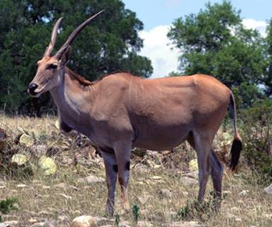
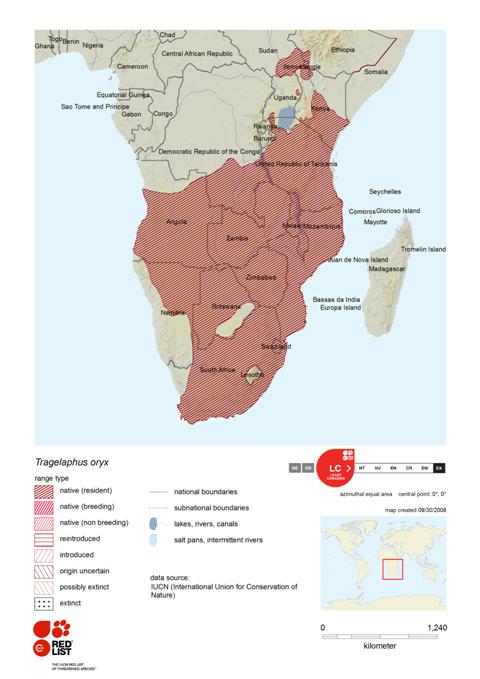
Common Eland (Tragelaphus oryx)
Range Map
Habitat and Ecology
Common Eland is one of the most adaptable ruminants, inhabiting subdesert, Acacia savanna, Miombo woodland and alpine moorlands to 4900 m. It is not found in deep forest, in true deserts or in completely open grassland, though it does occur in grassland with good herb cover. Common Eland is primarily a browser and moves long distances in search of ephemeral food sources; it can go without water for prolonged periods, able to obtain sufficient moisture from its food.
Source: IUCN SSC Antelope Specialist Group. 2008. Tragelaphus oryx. 2008 IUCN Red List of Threatened Species. http://www.iucnredlist.org/details/22055.
* All information on “Habitat and Ecology” (shown in blue) is provided verbatim from IUCN’s website.
Species Account
Tragelaphus oryx on the Animal Diversity Web at the University of Michigan Museum of Zoology.
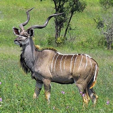
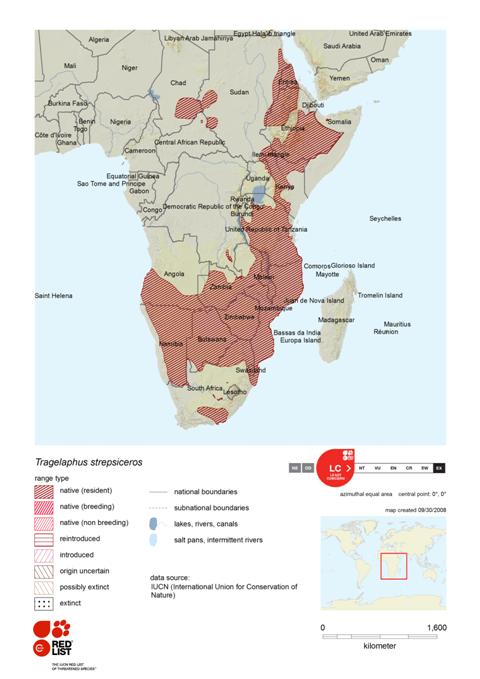
Greater Kudu (Tragelaphus strepsiceros)
Range Map
Habitat and Ecology
Preferred habitat includes mixed scrub woodland (it is one of the few large mammals that thrives in settled areas—in the scrub woodland and bush that reclaims abandoned fields and degraded pastures), Acacia and Mopane bush on lowlands, hills, and mountains. It has been recorded to 2400 m in Ethiopia. Greater Kudu is a browser; it can exist for long periods without drinking, obtaining sufficient moisture from its food, but becomes water dependent at times when the vegetation is very dry.
Source: IUCN SSC Antelope Specialist Group. 2008. Tragelaphus strepsiceros. 2008 IUCN Red List of Threatened Species. http://www.iucnredlist.org/details/22054.
* All information on “Habitat and Ecology” (shown in blue) is provided verbatim from IUCN’s website.
Species Account
Tragelaphus strepsiceros on the Animal Diversity Web at the University of Michigan Museum of Zoology.
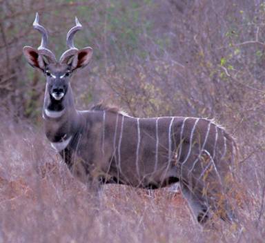
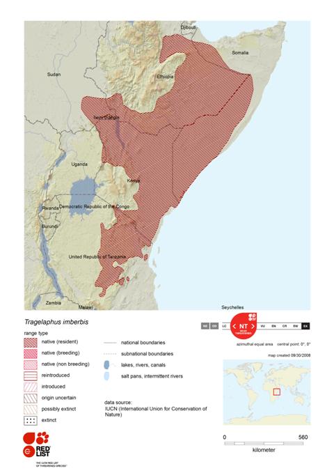
Lesser Kudu (Tragelaphus imberbis)
Range Map
Habitat and Ecology
Lesser Kudu is closely associated with Acacia-Commiphora thornbush in semi-arid areas of northeastern Africa; it generally avoids open spaces and long grass. It has been recorded at about 1740 m near Mt. Kilimanjaro. Lesser Kudu is primarily a browser, consuming mainly leaves of trees, shrubs and herbs, and its water requirements can largely be fulfilled from the water content of the food plants.
Source: IUCN SSC Antelope Specialist Group. 2008. Tragelaphus imberbis. 2008 IUCN Red List of Threatened Species. http://www.iucnredlist.org/details/22053.
* All information on “Habitat and Ecology” (shown in blue) is provided verbatim from IUCN’s website.
Species Account
Tragelaphus imberbis on the Animal Diversity Web at the University of Michigan Museum of Zoology.
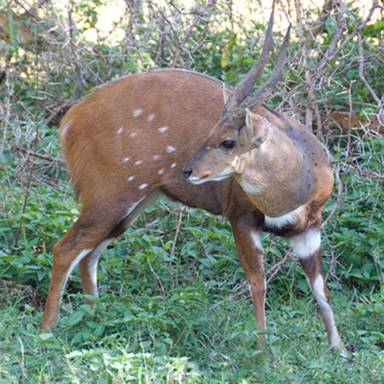
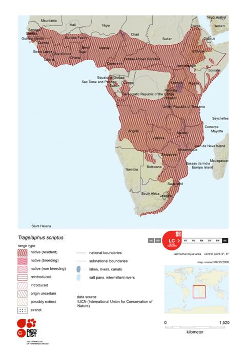
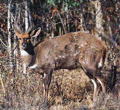
Common Bushbuck (Tragelaphus scriptus)
Range Map
Habitat and Ecology
Bushbuck occurs widely in sub-Saharan Africa wherever there is cover to conceal it, from sea level to 4000 m and from rainforest edge to patches of gallery forest and bush near water in the subdesert. It is naturally absent from arid and semi-arid regions and from extensive areas of closed-canopy forest. Its ability to survive in human-dominated landscapes and to withstand heavy hunting pressure has enabled it to persist over much of its former range. Bushbuck is primarily a browser; in some areas, it enters agricultural fields to eat crops and may be considered a pest.
Source: IUCN SSC Antelope Specialist Group. 2008. Tragelaphus scriptus. 2008 IUCN Red List of Threatened Species. http://www.iucnredlist.org/details/22051.
* All information on “Habitat and Ecology” (shown in blue) is provided verbatim from IUCN’s website.
Species Account
Tragelaphus scriptus on the Animal Diversity Web at the University of Michigan Museum of Zoology.
Menelik’s Bushbuck (Tragelaphus scriptus meneliki)
Range Map
Not recognized as subspecies for listing by IUCN (see Common Bushbuck for further information).
Habitat and Ecology
Assumed to be no different from Common Bushbuck (see Common Bushbuck for further information).
Species Account
Assumed to be no different from Common Bushbuck (see Common Bushbuck for further information).